Los Angeles Land Surveying

Land surveying services are not always easy to find in Los Angeles. If you want land surveying services in Los Angeles, LA LiDAR is the company for you. We specialize in land surveying and mapping, and we provide our clients with comprehensive surveys of their land. Our land surveyors have a diverse range of experience that spans decades. They can handle any project, from simple boundary surveys to complex site planning work for large-scale infrastructure projects like hospitals or power plants. Reach us today at (323) 366-3538.
About LA LiDAR
LA LiDAR is a company that provides land surveying services. We provide our clients with comprehensive land surveys. We can handle any land survey job from simple boundary to complex site planning work for large-scale infrastructure projects like hospitals and power plants.
LA LiDAR has a diverse range of experience spanning decades where they have handled all types of land surveys. We are land surveyors who can handle land surveying from simple boundaries to complex site planning work for large-scale infrastructure projects like hospitals and power plants.
What is Land Surveying?
Land surveying is a process of measuring and mapping the earth’s surface. This includes natural features, such as mountains and rivers, and artificial features like roads and buildings. Land surveyors are responsible for taking measurements from one point to another to create an accurate map of the land in question. They can determine how much land is available or any obstacles that might come up when developing it later on. They may also be asked to determine what type of soil is present, so developers know what plants will grow well in certain areas. The data collected by a land surveyor can help people make informed decisions about where they want to buy a property or invest their money into building new structures that will be safe and profitable.
Why Survey a Property?
When it comes to buying a home, the first step is usually surveying the property. The surveyor will take measurements of all aspects of the land and create an accurate diagram that indicates any potential problems with its size or shape. A professional survey service can help you determine whether any issues may need to be addressed before moving forward with your purchase.
It’s essential to survey a property before purchasing it. This is because the land’s condition may not be what you expect if you’re unfamiliar with the area, which could lead to costly repairs or even structural damage that will affect your investment. A professional surveyor can provide you with detailed information about the land, such as its boundaries, topography, structures on site, utilities available, and much more so that there are no unpleasant surprises later on. Contact LA LiDAR at (323) 366-3538.
Process of Surveying
The land surveying process is a crucial step in the construction of any building. It provides essential information to architects, engineers, and electricians about where they can place structures or how far from buildings certain utilities need to be located. This helps ensure that all infrastructure will function safely and efficiently after the project is complete.
The process of land surveying is a multi-step procedure that starts with the acquisition and analysis of survey data. The process can be broken down into five steps: data acquisition, field recording, datum adjustment, map production, and cartographic design.
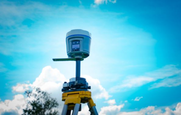
To acquire this information, we use different types of equipment such as GPS systems or total stations, which measure distances between two points on a horizontal plane. This data is then analyzed using software programs like AutoCAD Civil 3D or ArcGIS Pro, which are used for calculating angles, slopes, and elevations concerning the XYZ coordinate system. After all, calculations have been made. We adjust the coordinates, so they are referenced to a common vertical datum (typically WGS84), and this is how land surveyors can compare one map to another. Lastly, the land surveyor will design a map with all of these calculations incorporated for client use.
How Much Does it Cost to Survey a Property?
Many people considering a new home purchase want to know the property’s condition before they decide on their offer. If you’re in this boat, it’s important to understand how much it costs to survey a property? Many professionals will charge $2-3 per square foot for an inspection that includes checking out utilities and assessing any damage or other issues with the house. The total cost can vary depending on the size of your lot and if you need anything inspected outside of your home.
Contact LA LiDAR
If you have any questions about land surveying or a property inspection, contact LA LiDAR. We are experts in land and home surveys, so we can help you make the right decision for your future. Our surveyor company also offers services including drone mapping, topological mapping, and photogrammetric mapping. Give us a call today at (323) 366-3538!

